The gentle sea at that time was soaking itself to the luminance of the Sun. The sparkle of it was sequin placed all around the great blue attire but for that time was crimson red.
A boy-man was looking at the horizon, as it was looking endless as his thoughts were. In a few days, he is about to take his first journey to that vast infinity and was asked by Moopan to gazing at a star-studded sky that night. Moopan is very old, old enough many in the village claim he is more than a hundred years old. He is profoundly mystic and doesn't speak much. You would mostly find him in the temple of Neelayadhakshi or in one of the creeks where Kaveri empties herself. He gazes at the sky and draws various sketches on the wet soil, multiple arcs, intersecting lines, which does not make any sense. When asked, the answer would be his profound and disturbing silence. Moopan has accompanied gone for many voyages. In one of those voyages, his shipwrecked. All were assumed dead. Except but him, a fine day, he just rose from the sea. He knows Vanga kadal (Bay of Bengal) very well. And he is the profound master in keeping time and watching the sky. He speaks to the turtle as though both know each other for a very long time and sometimes give them medicines. His name was Arata Mooki, but after the shipwreck incident, everybody calls him Moopan.
Neelan was deep in his thoughts, but at times amidst all these uncertain and anxious moods, he remembered Kumudha. Kumudha's dark wide eyes and her eyebrows had shrunk with the query of " when are you going to be back ?"
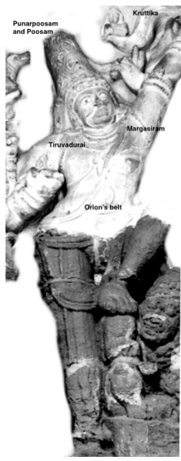
Let's leave Neelan to his musings and pivot ourselves to the journey he is about to endure. He's going cross the Bengal sea and reach Savakam. The voyage would generally commence before dawn on the eastern sky after sighting Mrigasiram( Bellatrix), Agastya(Canopus), Arudhra(Betelguese), and Kruttika (near to the bow of Arudhra on the Southern horizon). This journey commences well before Margazhi Pournami of Arudhra darshan. This is when Arudhra is sighted at dawn for the last time of the year in the eastern sky. Srilankan Tamils used to navigate from Jaffna till Chidambaran to participate in Arudhra Darshan.
Interestingly, Pallava's Gangadhara Shiva (Kanchi Kailasanatha) is assumed to be depicted with Orion belt, two dogs as Punarpoosam and Poosam, and Ganga as Kruttika. Aptly set to describing about Margazhi voyage.
Gangadhara Shiva (Kanchi Kailasanath)
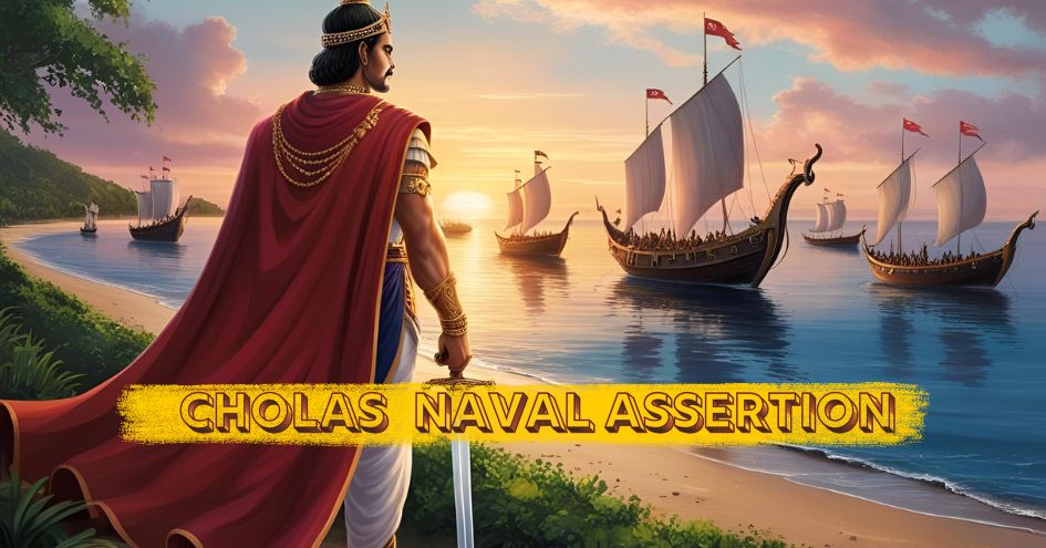
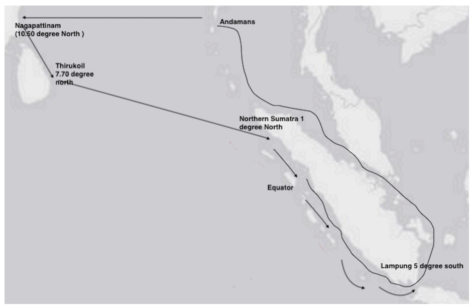
The port of embarkation was mostly from Nagapattinam and would have been the port for Rajendra's victory towards the east. The entire east from Ganga's mouth till the end of Srilankan cost was under his belt; the ships could have ventured in from anywhere in these lines. Bay of Bengal sea would have been his pond.
And if the journey begins after Margazhi, then Sharavana (alpha Aquila) raising on the eastern sky at dusk becomes the indicator. By then, Arudhra would be seen in the western sky during dusk. Later the season, the more southerly the latitude. The southward sail would not exceed Kalmunai, or after that during the season, it would be Tirukoil of Sri Lanka's eastern coast. The direction would of to follow Vada kondal (the prevailing wind) and Vada Olini (the currents). That would be today's Batticaloa. The eastern voyage would always be before cross Sangamkanda Turai at Tirukoil. It's hardly any guess why Cholas had the entire eastern coastline and half of Srilanka's western coastline under their control. The main one being Triconamalai, where Mahaweli Ganga, which originates from Kandi, empties herself there. The river mouth opening directs to their Cholas Srilankan capital Polonnaruwa. Triconmale was much famous for its oil and coal refilling, as it was during Cholas time till it was bombarded by Japan falling from grace to be called as Pearl harbour of British.
Along with the square of rectangle sails (lateen sails were not known then) in use, they would say nearly parallel to the equator circles around 5 to 7 degrees north. With the equatorial westerlies' help, it would land them in the Southern end of Sumatra, or if they and start early, would land them in the north of Sumatra.
The stars in the Orion belt, Ursa major (Sapta rishi Mandal/ Kappal Velli), are well observed and used for east to west sailing much clo the equator, making it more or less parallel sailing. In the early morning hours, the use of Mrigasiram and Arudhra till January and Tiruvonam in the evening sky ensured a due west to east sailing. With favourable wind systems and currents, they would reach the destination in 12 to 15 days.
Additional identifications are made by utilising other stars in Ursa Major. Arundhati was called Uthra meen (vada velli) or north star in India's southern side, mainly because Dhruv was not visible traveling at a latitude below 8 degrees north. The Dhruv (Pole star) is 89 degrees north, and it is most favourable in finding out latitude subjected to minor error. While it can be sited at a reasonable altitude, it's height falls progressively towards the equator. Since the interstellar distances are constant, making out the difference between Arundhathi and Dhruv in the arc, the value of 15 virals would help us determine the latitude. Viral being measured as 1/8th of yamam.
The distance cannot be physically measured, and hence the relative normal sailing distance under fair sea and speed under the watch of three hours becomes the versatile yamam. Eight yamams constituted a day's sail. A day was from sunrise to the next day's sunrise (not midnight to another). Initially used to measure time, it was started to be used to measure the distance which was covered in three hours. In seamen's language, an angular arc is 1/8th of viral, and yamam equivalent to 20 km. Precise measurement of the moment was never a concern of the traditional seamen who have taken up the responsibility of ensuring everybody's safety. A delayed arrival was of few days when safety is to be secured.
An early system of measure of the finger unit and closed fist held horizontally at the stretched hand distance was equal to 4 viral. And over time, it developed into simple hand tools. The Mediterranean seamen, especially the Portuguese, talk of using such a device known as Kamal (Arab mariners or Rapalagai as called in the south). A rectangular board with a hole in the exact center runs a string knotted and fixed at the board's back. The string itself has various knots without any proportion, as they indicated the specific ports, determined and set by repeated expeditions. Since the thread is bound to have the curve, the cross-staff was later used, and in Kerala, it was called Kau-kutty.
Traditional mariners develop a practical understanding of the starlit skies through repeated observation of the sky and harness the knowledge to steering the vessels. Lying on the back deck of a ship and to watch the starlit nights and to gaze at skies with ease and leisure, they were able to identify specific stars and track their motion from eastern skies towards the western horizon and note down the constancy in their position. Ancient Indian navigators regularly traversed the sea, finding new routes for trade and cultural exchanges, and certainly knew their art, navigation with heavenly bodies.
They were smart to assess with their practical voyage experience that they would overshoot the position sailing along the rhumb on a northerly voyage and hence reduced their time of sail, and they would have to travel a bit more when traveling south on a constant bearing.
They somehow knew the meridians converged. East to west traveling was less complicated than North-south, and the longitude assessment eluded till the nineteenth century. The Indian mariners never used longitude but found their indigenous solution, while the voyage has to be made north to south.
The sea route sans pirates was safer next to the silk road that was often disrupted with unpredictable political borders. After the Tang dynasty in China, the Sang laid more emphasis on sea trade. Rajendra Chola's expeditions should be interpreted in this context of an international trading system and their linked markets in China. Let's tread across more maritime trade Indian with a particular reference to Cholas, Srivijaya, Chinese, and Arabs. Their boats, their natural science on the next part.
 I am Nithya Ragunathan, was a banker by profession with Citi and Westpac , currently a director of a software firm, a bookworm and have fervent interest in asian history and heritage, for the most part the trade routes and maritime history.

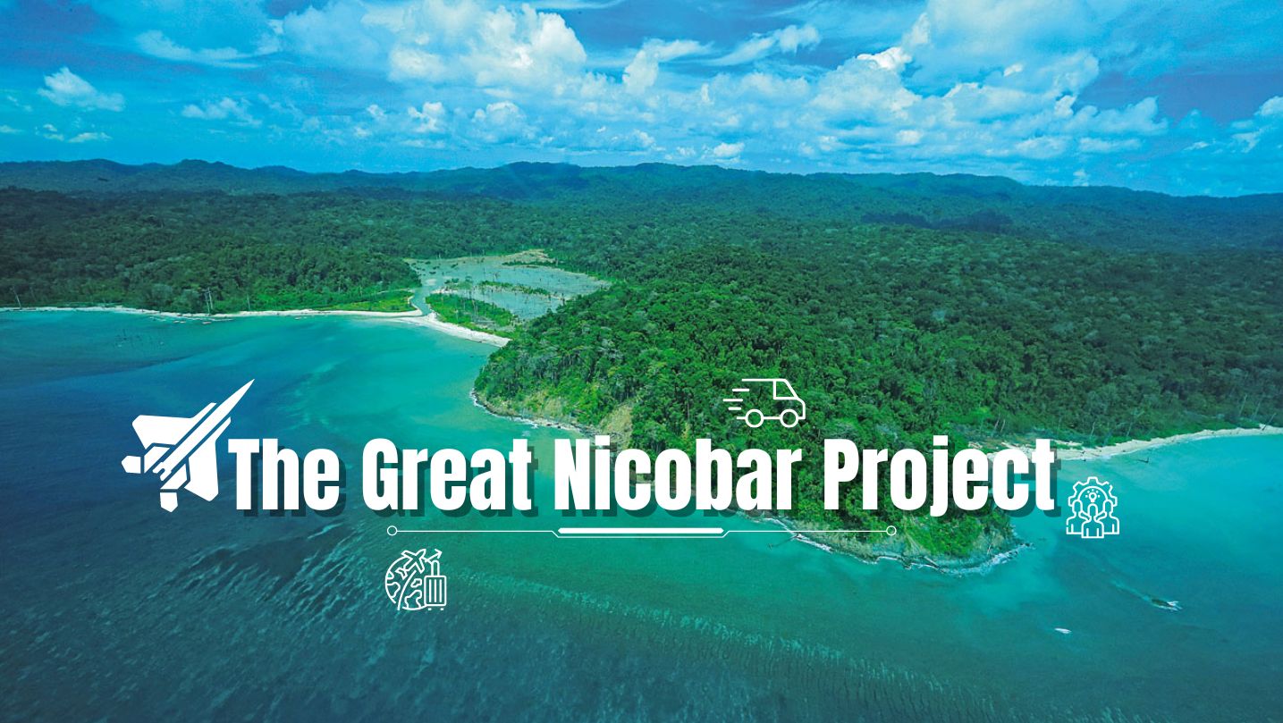
At the southernmost tip of this mesmerising ensemble lies the majestic Great Nicobar Island, boasting an impressive landmass of about 910 square kilom...
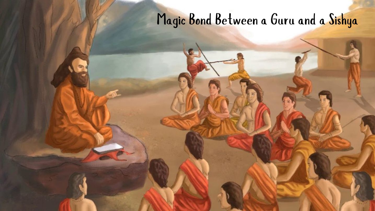
Bharath has always been a land traversed by spiritual masters/ Guru since time immemorial. These spiritual masters have always upheld the core princip...
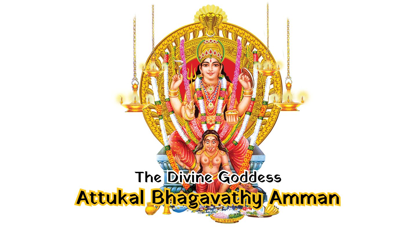
South India contains its fair share of unique pilgrimage centres. These divine places of worship have a prominent Sthala Purana, devoted followers, di...
Verandah Club is an initiative by few like-minds of Coimbatore who are interested to share information on various antiquities of Bharat.
Free download our iOS & Android app
© Copyright 2026, All Rights Reserved.