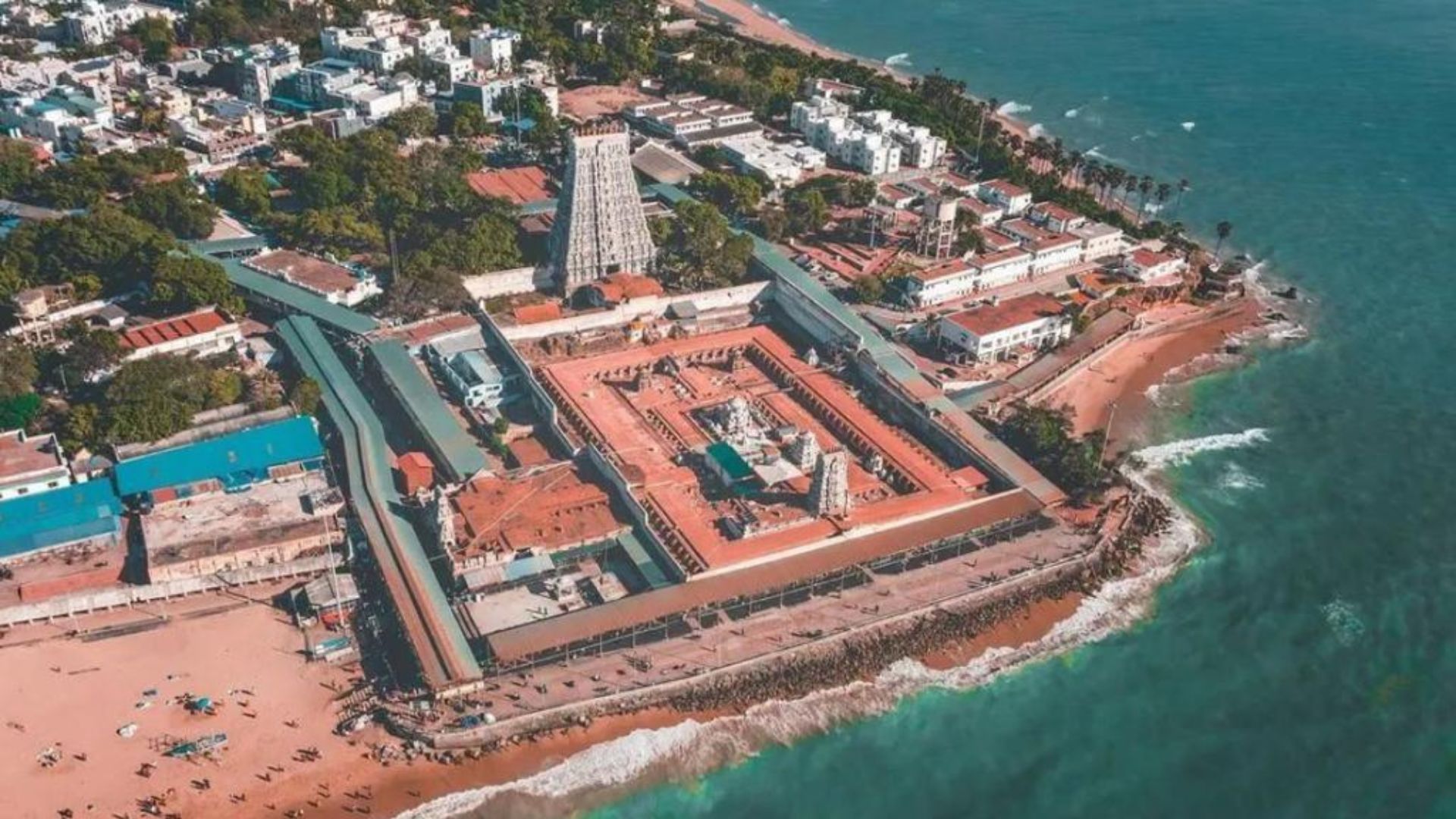
Thiruchendur Temple is an ancient Architectural and Geo-Technical Marvel on Earth located in Tuticorin District, Tamilnadu State, India.
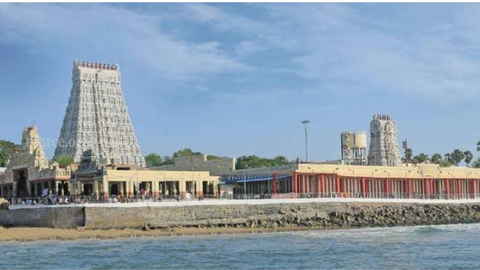
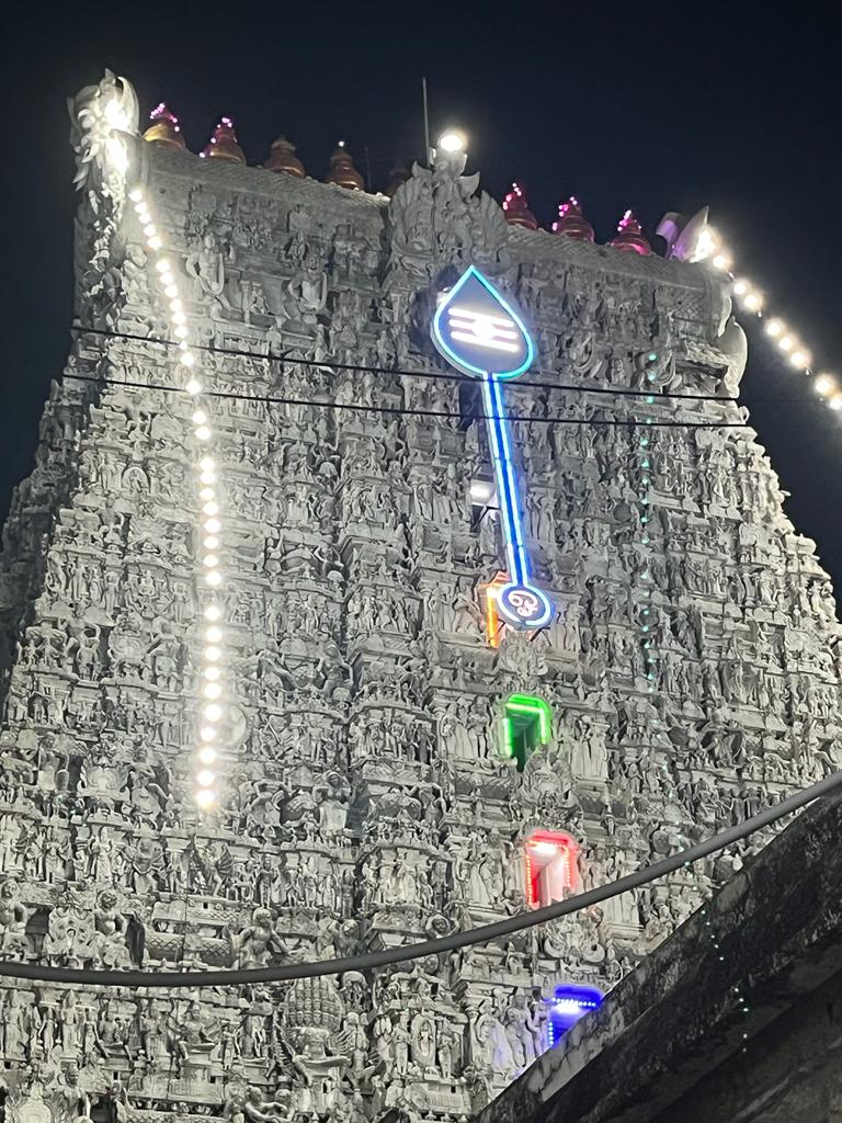
There is a very unique temple in Tamil Nadu, India Dedicated to Lord Kartikeya (also known as Murugan or Subhramanya). The Tiruchendur Murugan Temple is located in the Tuticorin district, Tamilnadu state. This Temple has been constructed about 2000 years before and amongst the largest temple complexes in South India, it has a lofty entrance tower measuring up to 140 feet. Over the course of centuries, various rulers, including the glorious Chera, Pandya and Chola dynasties have contributed to the construction of this magnificent temple. The temple is located very close by to the sea shore of Bay of Bengal. The extraordinary positioning of the temple and the ancient engineering/ Geo technical skills are very much appreciative. During the December 26th 2004 Tsunami, The killer waves destroyed everything around and close by to the temple. But it did not do any devastation to the temple and its close by premises/proximity. It is a fact that many witnesses and the glory of the ancient temple architecture, positioning of the temple location, geotechnical aspects involved in construction needs a thorough understanding as how a 2000 year old temple could withstand all the nature’s furies till date.
The History of the temple says that, in the 17th century, the Dutch, who had just started their colonies in India, were ruling most of Ceylon (now Sri Lanka) and southern coastal areas of Tamil Nadu. Like most of the rulers, they have looted the wealth of Hindu temples all over including the Thiruchendur Temple and set sail to their destination, while at sea, they met with a very massive cyclone. Someone on the ship told them that, it was the wrath of Lord Murugan and that they must throw the idol into the sea to save themselves. Accordingly, the idol was thrown overboard and the cyclone subsided. Historical legends say that Vadamalaiyappa Pillai, an ardent devotee of Lord Murugan, had a dream in which he was told of the idol’s positioning in the sea. With other devotees, Pillai discovered the idol submerged at a spot where a lemon was floating on the surface. Thus the “Panchadhatu idol” was reinstated once again in the temple.
The site’s geographic location, Geological Considerations had a major role to play to the safety of the temple from the killer Tsunami waves. The ancient temple architectural Engineers considered the natural elevation in the rocks broke the chain of the waves and also the crest of dune structure and various other geological and geotechnical aspects have been taken in to consideration by the scientific genius of the ancient Hindu Engineers of the age old era.
The study area geologically comprises of quaternary deposits of soil and recent tectonically formed coastal landforms. The geomorphology of landforms exists are basically dunes and wave cliffs and also of marine calcareous sandstone, rich in quartz and feldspar, with embedded Molluscs shells. The migration of beach dune is due to the sea wave and tidal impact, and it is generated new structures like cliffs. The effect of tsunami waves was more along the projected and flat beaches. The shallow shelf beaches were not affected by the tsunami waves. Tsunami inundation along the southern Mannar coast is moderate. While Tsunami impact along the northern Gulf of Mannar coast between Dhanushkodi and Thoothukudi is comparatively less due to the presence of 21 coral islands. The coast considered as raised coast consisting of coralline terraces. Moreover thanks to the presence of Sri-lanka, which saved the Gulf-of-Mannar coast of Tamilnadu by taking the direct hit and it was unlikely to affect the temple because the tidal wave energy also dissipates and does not affect the temple situated on the dune/wave cliff.
It is to say that the Geological importances of beach ridge are imperative towards the site selection by the ancient Engineers. Morphological features are thoroughly studied by the ancient Engineers along the beaches which are created by wave actions directly or indirectly and ultimately induce the sediment transport and beach changes. These morphological features define about berms and bars of beach profiles. Coastal geomorphology concerns the formation of landforms, influenced by atmospheric, oceanographic, geologic and hydrologic processes, etc. Were thoroughly taken in to consideration prior to Ancient Temple construction.
The beaches in these areas are gently sloping and formed by the plunge point due to wave action. Shoreline salients are low triangular landforms, which project seaward as promontories. The term “tombolo” is applied when this landform joins to an island or breaker. Islands refract incoming waves causing them to bend inward around the island and converge along the mainland in opposite directions. This process produces a net transport of sand in two directions towards the island, resulting in a spit of sand that grows outward from the shore. Prominent features present in the study area are dunes, backshore width, wave cut features and potholes, bays, spit, backwater zone, mudflat, and back swamp. Dunes are omnipresent in the areas along the temple location with Dune height of about 2 to 3 meters above sea level. We note that temples, especially the older/ancient ones in South India are Constructed with due consideration to all the presumed disaster with utmost Geological, Geotechnical and Engineering Skills. In Thiruchendur temple, if one walks into the temple could see the land descending towards the sea and dipping down. The narrow sandy beach near the temple is steeper at about (about 3-6°) than in areas further North (1-3°), followed by seaward by rocky shore platforms. The shore platforms mostly occur in between the low tide and the high tide, and are formed of marine calcareous sandstone, rich in quartz and feldspar, with embedded Mollusca shells. At Tiruchendur, the older shore platforms/beach ridges could also be found several meters above the mean tide level. Due Technical thoughts were involved in construction of temple on a flattened dune phase built upright with extraordinary foundation by taking in to consideration of all the location specific geological and geotechnical requirements. Also, the temple location has been chosen technically sound to Wade off any climatic issues and disasters that were very clearly foreseen by our very ancient Temple Engineers.
MURALI KOCHUKRISHNAN is a Freelance Consultant (Hydrogeology & Environment), Kerala and Tamil Nādu state.
NEXT ARTICLE


In the lush, green heart of Kerala lived an elephant who became a living legend - a tale of an elephant turned into a bakth. His name was Keshavan, bu...

The Chaitanya Charitamrita by Shri Krishna Das Kaviraj provides a vivid description of the operations management of Shri Gundicha Yatra during the tim...
The sun beat down on my back as we stepped out of the car, the air thick with the humidity of rural Tamil Nadu. Chinthalavadi, a small village nestled...
Verandah Club is an initiative by few like-minds of Coimbatore who are interested to share information on various antiquities of Bharat.
Free download our iOS & Android app
© Copyright 2026, All Rights Reserved.